Evidence-based design. Reliable delivery.
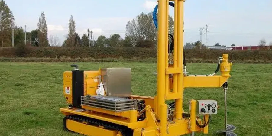
LEARN MOREGeotechnical investigation in Casper, Wyoming, forms the essential foundation for safe and durable construction across the region. This category encompasses all field and laboratory methods used to characterize subsurface soil, rock, and groundwater conditions. From residential foundations to large-scale energy infrastructure, understanding what lies beneath the surface is not just a regulatory step—it is a critical investment in risk management. In a landscape shaped by the North Platte River, windblown deposits, and sedimentary bedrock, a thorough investigation prevents costly surprises such as slope instability, expansive soils, or unexpected groundwater. Local firms commonly deploy a range of techniques including standard penetration tests, test pit logging, and specialized in-situ methods like the CPT (Cone Penetration Test) to gather continuous data on soil behavior.
Casper's geology presents a complex interplay of alluvial terraces, shale formations, and sandstone layers typical of the High Plains and intermontane basin setting. The downtown area and river corridor are underlain by unconsolidated Quaternary alluvium, which can vary dramatically in density and gradation over short distances. Upland residential developments often encounter the Cretaceous-age Cody Shale or Frontier Formation, materials known for their potential to heave or slake upon exposure. Wind-deposited loess and colluvial soils on hillsides add another layer of concern, particularly for cut-and-fill operations. These local conditions make a desktop study insufficient; physical exploration is needed to map bedrock depth, identify paleochannels, and assess the shrink-swell potential that has historically damaged light structures in Natrona County.
Regulatory compliance in Wyoming ties directly to the International Building Code (IBC), as adopted and amended by the City of Casper. Chapter 18 of the IBC mandates a geotechnical investigation for all structures except those falling under very specific exemptions for minor, non-hazardous accessory buildings. The Casper building official requires a sealed geotechnical report that addresses bearing capacity, lateral earth pressures, and seismic site class per the USGS seismic hazard maps. Wyoming’s seismic risk, while moderate, is influenced by the proximity of the Yellowstone volcanic system and regional fault networks, making site-specific ground motion analysis a common prerequisite for essential facilities. Furthermore, the Wyoming Department of Environmental Quality oversees groundwater monitoring and contamination assessments, which often intersect with geotechnical borings on brownfield or industrial sites.
The types of projects that demand a comprehensive investigation in Casper span from single-family homes on sloping lots to major public works. Commercial developments in the expanding east-side commercial districts require deep foundation recommendations due to variable fill soils. Wind energy projects prevalent in the surrounding plains rely on CPT (Cone Penetration Test) data to design turbine bases capable of withstanding high overturning moments. Roadway widenings along Interstate 25 and bridge replacements over the North Platte River necessitate detailed scour analysis and abutment design parameters. Even smaller ventures, such as retaining walls exceeding four feet or swimming pool installations, trigger the need for a licensed engineer’s subsurface evaluation to prevent differential settlement that plagues Casper’s older neighborhoods.
Under the City of Casper’s adoption of the International Building Code, a geotechnical investigation is required for virtually all new structures and substantial additions. Exemptions are rare and limited to very small, uninhabited accessory buildings. The report must be prepared by a licensed engineer and include site-specific data on soil bearing capacity, lateral pressure, and seismic classification to secure a building permit.
Expansive clay shales, particularly from the Cody Formation, are the primary cause of foundation distress in Casper. These soils undergo significant volume changes with moisture fluctuation, leading to slab heave and cracking. Unconsolidated alluvium along the river corridor can also cause differential settlement, while colluvial soils on hillsides pose slope stability risks if not properly investigated during the design phase.
Although Wyoming is not a high-seismicity state like California, Casper projects must evaluate site class per IBC and ASCE 7 standards using near-surface shear wave velocity measurements. The report assigns a seismic site classification, typically based on Standard Penetration Test blow counts or CPT data, to determine design spectral accelerations. This is especially critical for schools, hospitals, and emergency response facilities.
A commercial investigation in Casper generally includes a series of exploratory borings extending below the anticipated zone of influence, often 20 to 40 feet deep. Fieldwork commonly combines Standard Penetration Testing with selective sampling for laboratory analysis of moisture content, Atterberg limits, and consolidation properties. For sites with complex stratigraphy, continuous profiling via CPT testing is frequently added to refine the subsurface model.
We serve projects across Casper Wyoming and surrounding areas.